Tropical Storm Cristobal Forecast Verification
Written by Derek Ortt on May 16, 2009
Track forecasts for Cristobal had less error than the long-term mean and CLIPER. Most of the forecast error that was present was due to indicating a track that would turn sharper to the east than what occurred. The forecasts near the East Coast were quite good with the forecasts indicating either a near miss or barely moving inland. The center remained just east of the Carolinas.
Intensity forecasts were also quite skillful, though they did not quite anticipate the intensification as the storm moved away from the Carolina Coast. This is not the first time this has happened, as it was the case with Hurricane Alex in 2004 as well.
Updates indicated that tropical storm conditions were expected for the Carolina Coast. However, the tropical storm force winds remained offshore.
For synoptic history, and official watches and warnings, please see the National Hurricane Center Tropical Cyclone Report
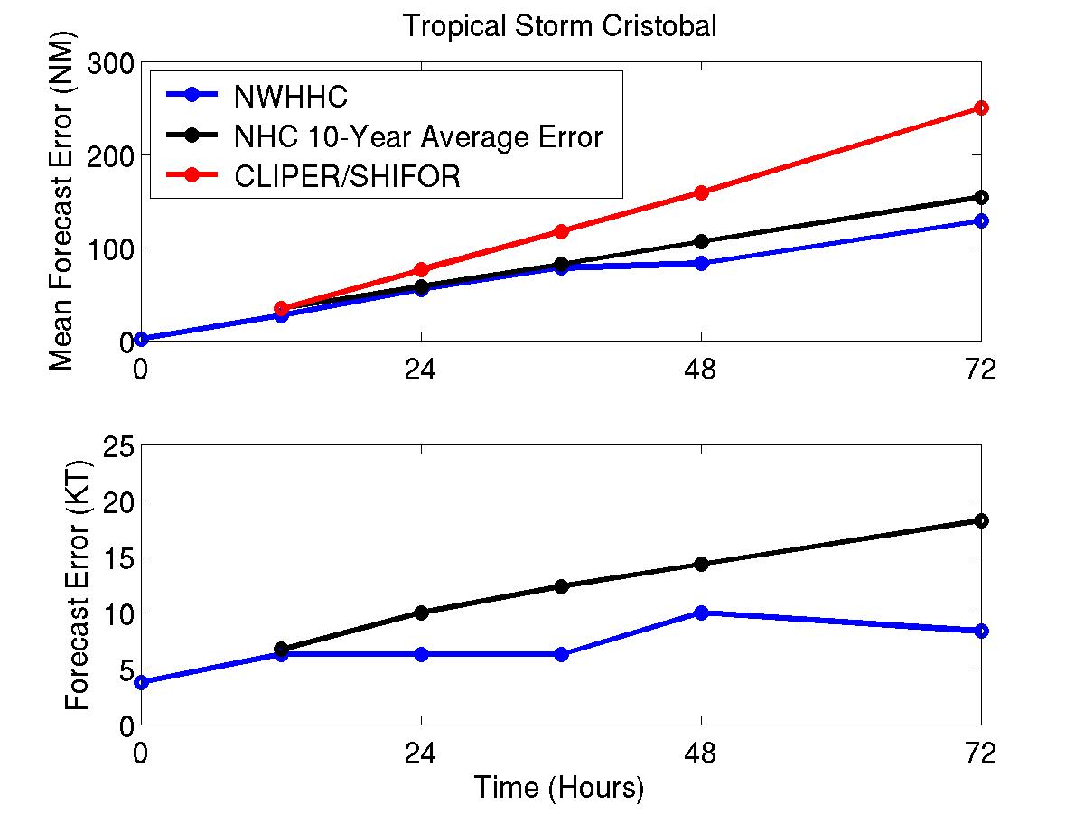
Figure 1: Mean Track (top) and intensity (bottom) forecast errors for Tropical Storm Cristobal. The blue represents the NWHHC forecasts, red the best track and black the long-term error.
Click Here for individual track/intensity forecast error statistics.
Back to Verification Index