Hurricane Bertha Forecast Verification
Written by Derek Ortt on May 19, 2009
Track forecasts for Hurricane Bertha were in general, quite good. The mean track forecast error, as shown in Figure 1, was well below that of CLIPER and the long-term mean. However, there were three main track issues with Bertha. The first was depicting a westward track too long while it was in the deep tropics. However, many of the models and ensembles showed the same. A second was keeping the storm too far east of Bermuda. The third was associated with the looping motion after it cleared Bermuda and eventual acceleration into the open Atlantic.
Intensity forecasts also were quite good on the whole. However, the rapid intensification on July 7 was not expected. This lead to a few forecasts having intensity errors approaching 60KT. Most of the other intensity forecasts had very low errors.
Updates indicated that tropical storm conditions were likely for Bermuda only after tropical storm force winds were reported on the islands. This was due to the forecasts keeping Bertha well east of Bermuda. While Bertha did remain well east of the islands, the pseudo eyewall covered a large diameter and the strongest winds were located west of the center. This statement was first included at 1200 UTC July 14, and was removed from updates at 0300 UTC July 15. In the future, additional consideration must be payed to storm structure, to prevent this type of mistake from happening again.
For synoptic history, and official watches and warnings, please see the National Hurricane Center Tropical Cyclone Report
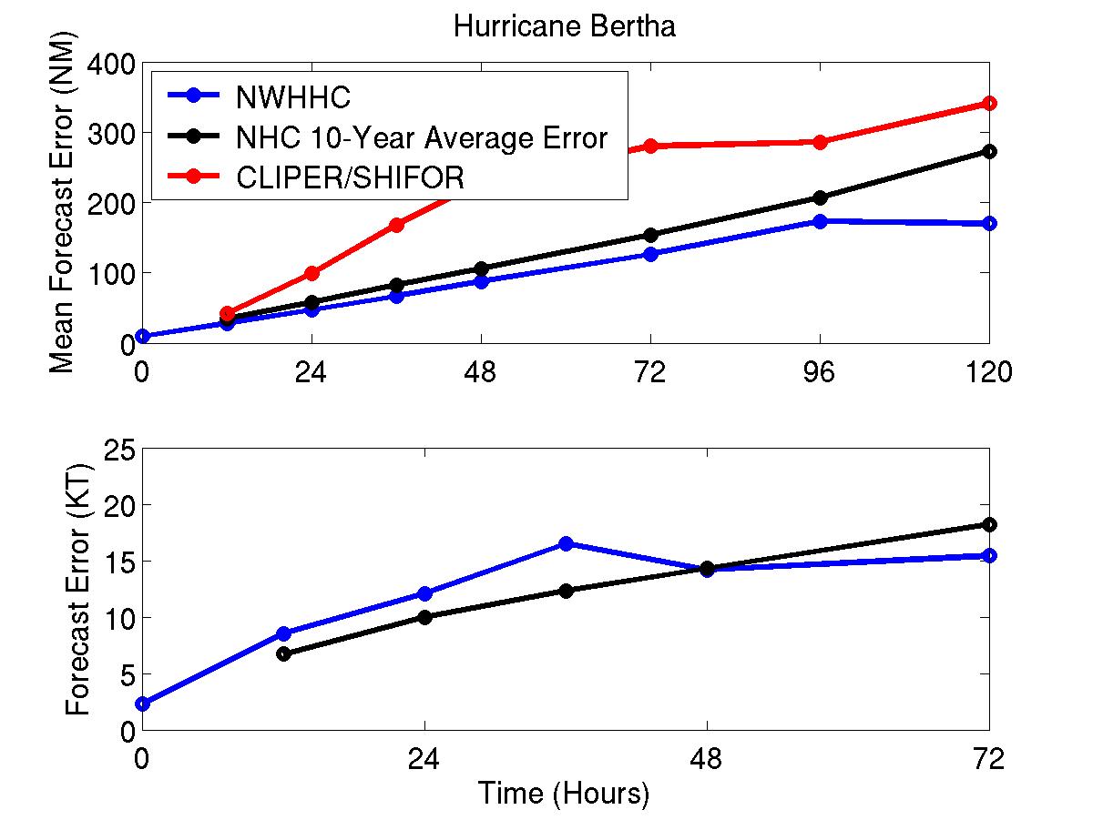
Figure 1: Mean track (top) and intensity (bottom) forecast errors for Hurricane Bertha/ Blue denotes the NWHHC forecast, black, the long-term mean, and red, CLIPER
Click Here for individual track/intensity forecast errors
Back to Verification Index