Hurricane Karen Forecast Verification
Written by Derek Ortt on December 4, 2007
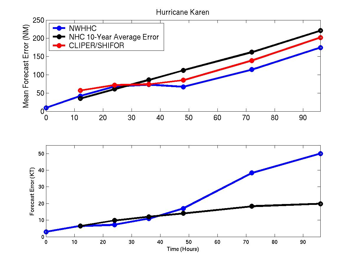
The track forecasts for Hurricane Karen were very good with the errors at all time periods being less than those from CLIPER. however, the 12 and 24 hour mean error were greater than the 10-year NHC mean error. A likely cause for this is due to the slowdown when Karen weakened from hurricane intensity not being forecast. There were some rather large 12 and 24 hour forecast errors at these times. At the 48-96 hour time periods, the forecast errors were well below the long-term mean.
Karen was another storm that produced significant intensity forecast errors. The primary reason was the vertical shear was greater than expected and impacted the storm earlier than expected. Some of the initial forecasts indicated that Karen would reach category 2 intensity.
In real time, Karen was carried as a tropical storm. Best track analysis based upon recon data and previous satellite appearance indicated that Karen had become a hurricane. In real time, Karen was analyzed to be a 50KT tropical storm, producing a 15KT initial error.
For synoptic history, please see the National Hurricane Center Tropical Cyclone Report
 Click Here for individual track/intensity forecast error statistics.
Back to Verification Index
Click Here for individual track/intensity forecast error statistics.
Back to Verification Index