Tropical Storm Ingrid Forecast Verification
Written by Derek Ortt on December 5, 2007
The track forecasts for Ingrid had a mean error below the 10-year NHC mean error and that of CLIPER. At the 72 and 96 hour time periods, these forecasts were about 50 and 25 percent of the CLIPER error. This is indicative of forecasts that had a very high level of skill. The forecasts correctly indicated a track a little north of due west between 12 and 14KT. There were no verifying 120 hour forecasts as Ingrid dissipated less than 120 hours after it formed.
The intensity forecast errors from 12-72 hours were below the long-term mean. However, the error at 96 hours was significantly greater than the mean. The 96 hour error was 40KT. The reason for this is due to the effects of the shear not being anticipated in the first two forecasts. Starting with forecast 3, the shear was forecast to impact the storm. The dissipation of Ingrid resulted in the forecasts having errors of 5-10KT not being included in the sample since a system must at least be a depression to be included in th verification.
For synoptic history, please see the National Hurricane Center Tropical Cyclone Report
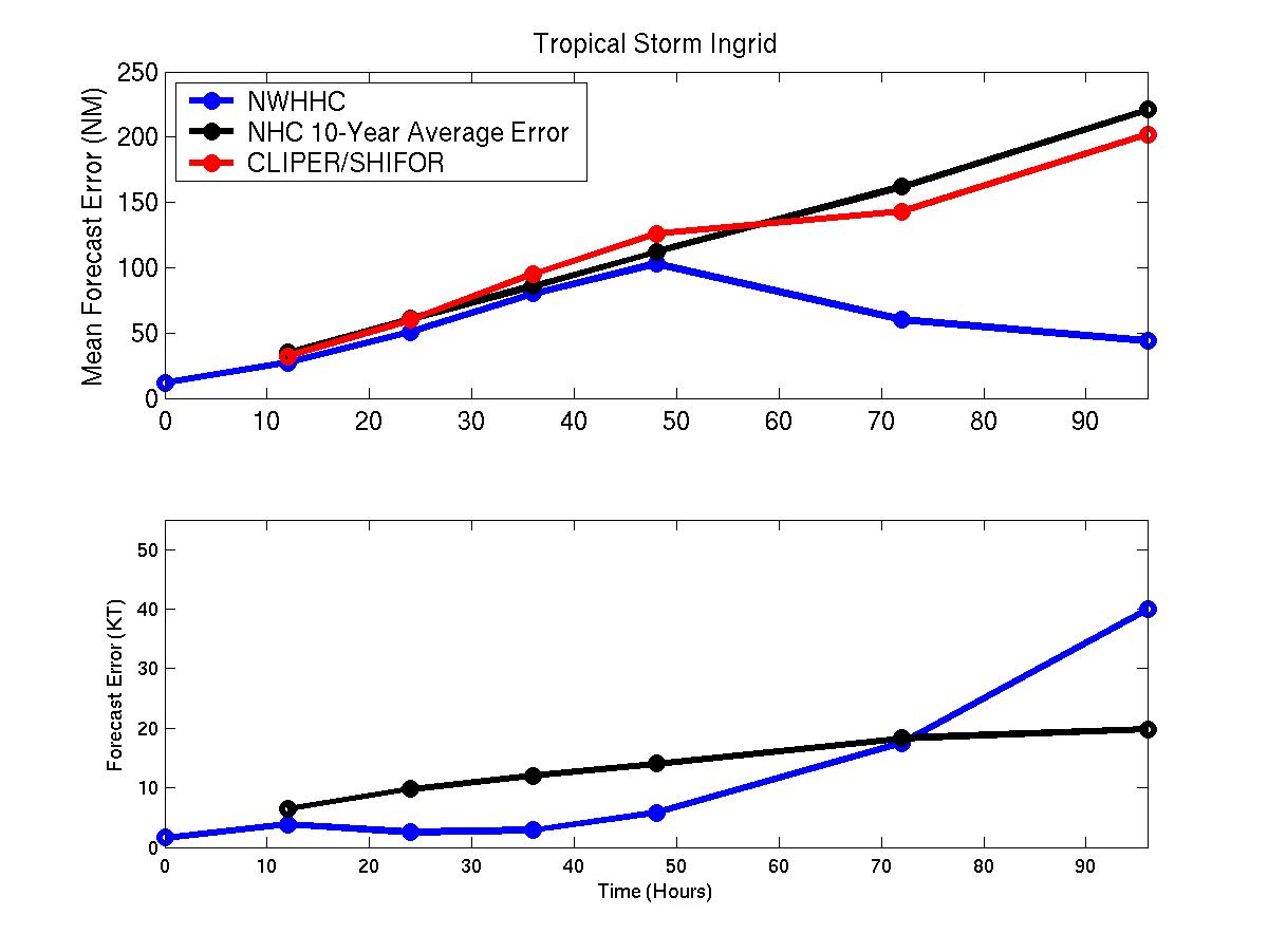
Mean track and intensity errors for Ingrid
Click Here for individual track/intensity forecast error statistics.
Back to Verification Index