Tropical Storm Gabrielle Forecast Verification
Written by Derek Ortt on December 3, 2007
There were only two track forecasts issued for Gabrielle. Forecasts were initiated once the system made the transition from a subtropical to a tropical storm. Landfall occurred around the time that the third forecast would have been due out; therefore, forecasts were terminated and the third forecast was not issued. After the storm moved back into the Atlantic, it was clear that the storm would dissipate and forecasts were not resumed.
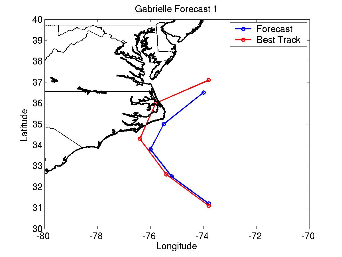
The track errors for the two forecasts issued had errors well below the long term benchmarks, with 48 hour forecast errors under 50NM for the forecasts. However, even with this small error, the first track forecast did not indicate a landfall. Instead, the track forecast, shown in Fig. 1, kept the storm just east of the Outer Banks.
The intensity forecasts were poorer. There are two reason for the larger intensity errors. The first is that the vertical shear was a little stronger than expected. The second was the fact that Gabrielle made landfall when it was not forecast to.
The tropical storm warning was only recommended about 6 hours prior to landfall. However, this still provided adequate lead time. Most of the high winds and rains were located to the south of the center due to the vertical shear. Ideally, a warning should have been recommended 6 hours earlier. However, after Katrina, NWHHC has tried not to recommend an initial warning for a location at 11 p.m. AST since many are not paying attention to the storm situation at that time and preparation action is limited.
For synoptic history, as well as official watches and warnings, please see the National Hurricane Center Tropical Cyclone Report.
 Click Here for individual track/intensity forecast error statistics.
Table of Recommended Watches and Warnings
0900 UTC 9/9 Tropical Storm Warning: Morehead City, NC to Kitty Hawk, NC
Click Here for individual track/intensity forecast error statistics.
Table of Recommended Watches and Warnings
0900 UTC 9/9 Tropical Storm Warning: Morehead City, NC to Kitty Hawk, NC
1500 UTC 9/9 Tropical Storm Warning Extended: North to NC/Virginia Border
2100 UTC 9/9 Tropical Storm Warning Dropped: Morehead City to Cape Hatteras, NC
0300 UTC 9/10 All TS Warnings Dopped
Back to Verification Index