Tropical Storm Erin Forecast Verification
Written by Derek Ortt on April 27, 2008
The track forecast errors for Erin were larger than the National Hurricane Center 10-year mean forecast errors. However, the errors were much smaller than those of CLIPER, indicating that the forecasts had skill. The main source of error was related to the poorly defined center. The 0 hour forecast error was greater than 20NM. Track forecasts also had a southward bias.
Intensity forecast errors were well below those of SHIFOR, but near or greater than the 10-year NHC mean error. The forecasts indicated too much organization. The intensification was based upon a good satellite signature, which obscured the fact that the surface center was poorly defined. Figure 1 shows the mean forecast errors.
A Tropical Storm Warning was recommended about 10.5 hours before landfall. While Erin crossed the coast just after the winds dropped below tropical storm intensity, tropical storm force wind gusts were recorded.
The intensification over Oklahoma was not expected and no forecasts or updates were issued during that phase of Erin.
For synoptic history, and official watches and warnings, please see the National Hurricane Center Tropical Cyclone Report
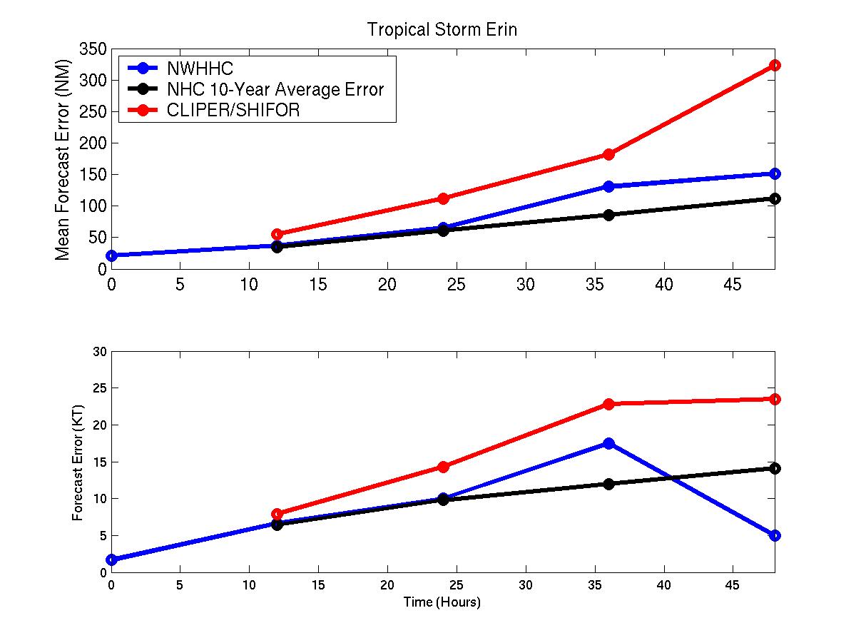
Mean track/intensity forecast errors for Tropical Storm Erin. Blue denotes mean forecast errors, black the NHC 10-year mean error, and red CLIPER/SHIFOR mean error.
Click Here for individual track/intensity forecast error statistics.
Back to Verification Index