Hurricane Helene Forecast Verification
Written by Derek Ortt on June 23, 2008
The mean track forecast errors for Helene were comparable with the long-term mean at all time periods. However, at the 120 hour period, the mean error was significantly higher than that of CLIPER. This indicates that the 120 hour track forecasts had no skill. The main source of error was associated with the recurvature and NE acceleration. Some forecasts indicated recurvature around 62W. Helene recurved at 57W. After recurvature, forecasts had a north bias. These errors are summarized in the upper panel of Fig. 1.
The mean intensity errors were below the long-term mean at all time periods, except for the 24 hour period. However, except for the 12 hour period, they were below those of SHIFOR. The error was due to underforecasts during the intensification period, and overforecasts once Helene became a major hurricane. These errors are shown in the bottom panel of Fig. 1.
For synoptic history, please see the National Hurricane Center Tropical Cyclone Report
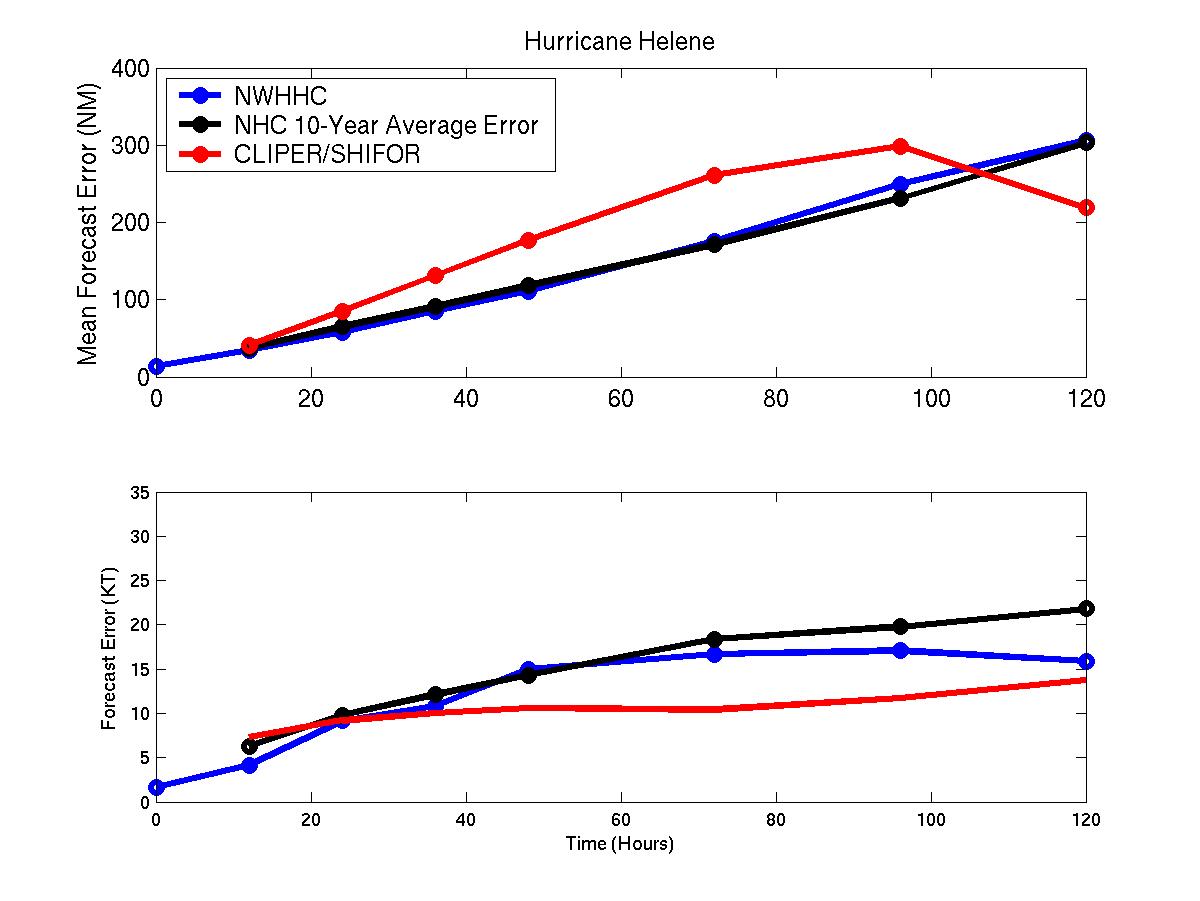
Figure1: Mean track/intensity errors for Hurricane Helene. Blue represents NWHHC forecast, black, NHC 10-year mean, and red CLIPER/SHIFOR
Click Here for individual track/intensity error statistics.
Back to Verification Index