Hurricane Gordon Forecast Verification
Written by Derek Ortt on June 19, 2008
Track forecast errors for Hurricane Gordon were well above the long-term mean beyond 36 hours. However, the errors were less than those of CLIPER at all time periods. This indicates that the track forecasts had some skill and that Gordon was a difficult storm to forecast. There were two main sources of error. The first was on the timing of recurvature. Initial forecasts indicated that Gordon would move a little farther west than it did and recurve later than it did. The second was after recurvature related to the forward speed. The slow motion from September 14-17 was not expected until it had already begun.
Intensity forecast errors were greater than the long-term mean and SHIFOR, indicating no forecast skill. The forecasts tended to have a low bias and did not anticipate the intensification into a major hurricane. The mean intensity, and track, forecast errors are shown in Fig. 1.
A Hurricane Watch was recommended for the Azores Islands at 2100 UTC September 18 and a Warning at 0300 UTC September 19. The warning was dropped for the western Azores Islands at 0000 UTC September 20, and dropped for the remainder of the islands at 0900 UTC. Hurricane force wind gusts did impact the Azores, though sustained hurricane conditions did not.
For synoptic history, and official watches and warnings, please see the National Hurricane Center Tropical Cyclone Report
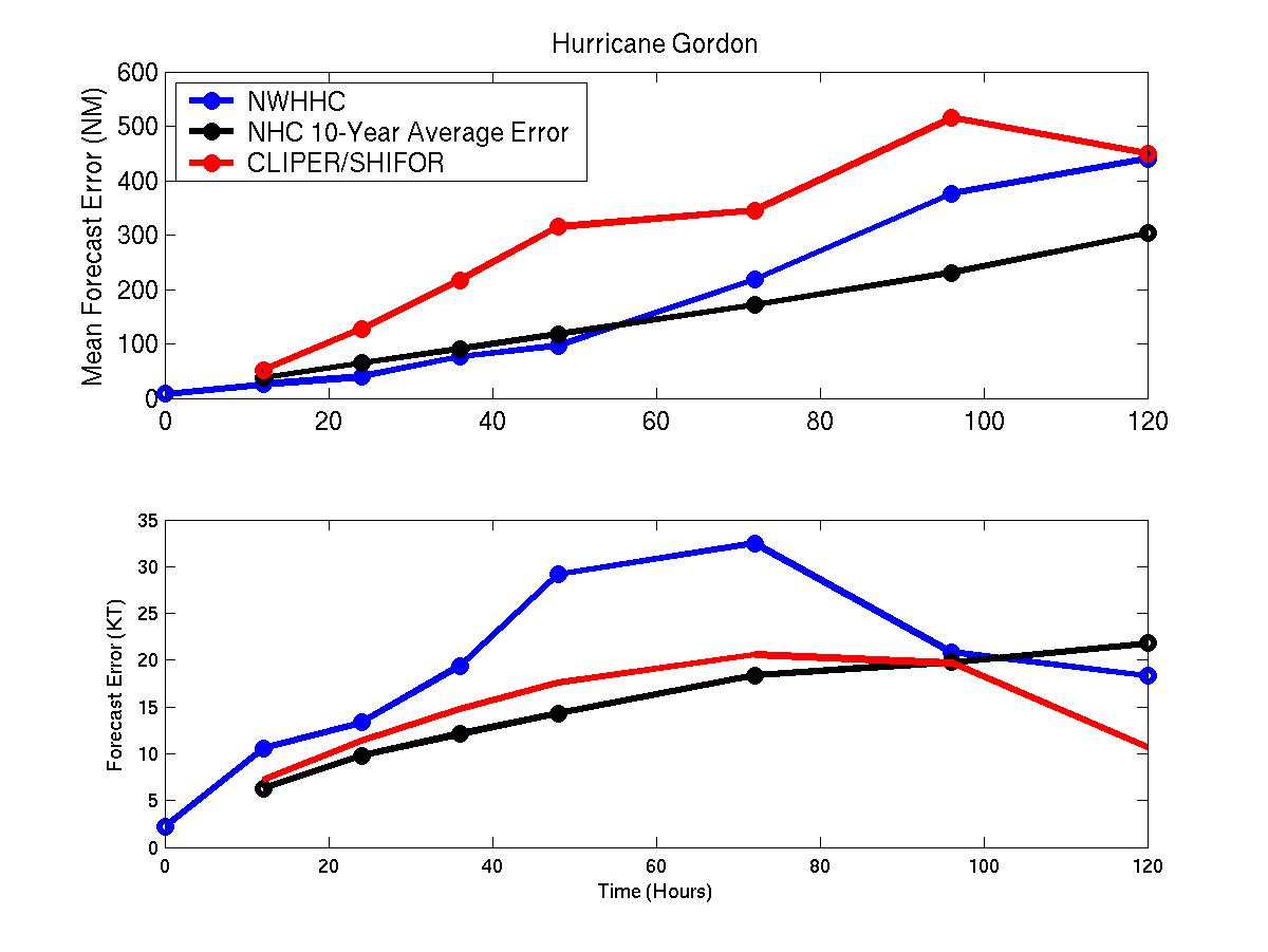
Figure 1: Mean track (upper) and intensity (lower) forecast error for Hurricane Gordon. Blue represents NWHHC mean error, black the 10-year NHC mean error, and red the mean CLIPER/SHIFOR error
Click Here for individual track/intensity forecast error statistics.
Back to Verification Index