Hurricane Florence Forecast Verification
Written by Derek Ortt on June 20, 2008
Track forecast errors for Florence were well below the long-term mean for all time periods after 48 hours and were comparable to the mean prior. The track forecast error was higher at the shorter time periods due to problems in determining the initial position. Florence for the first several days of its existence, had a broad, disorganized center. Some initial position errors exceeded 70 NM. This causes the short term forecasts to be relatively poor. At all time periods, the mean track forecast error was less than that of CLIPER. The mean track forecast error is shown in the upper panel of Fig. 1. As the storm neared Bermuda, forecast accuracy improved. Figure 2 shows the 11th track forecast issued on Florence from 1500 UTC September 8. The 72 hour forecast had a track error of only 20NM.
The mean intensity forecast error was below the long-term mean, but greater than that of SHIFOR. Figure 1 (lower panel) shows the mean intensity errors. The main source of error was over-forecasting the intensity near Bermuda. Many forecasts indicated that Florence would impact Bermuda as a major hurricane. Instead, it impacted the island as a 75KT category 1 hurricane.
A Hurricane Watch was recommended for Bermuda at 0300 UTC September 9. The Hurricane Watch was recommended for Bermuda with greater than usual lead time due to the large size of the tropical storm force wind radii. A Watch was also recommended for Newfoundland. This was changed to a Tropical Storm Warning but was dropped before the storm reached Newfoundland due to Florence becoming extra-tropical. Table 1 provides the recommended watches and warnings.
For synoptic history, and official watches and warnings, please see the National Hurricane Center Tropical Cyclone Report
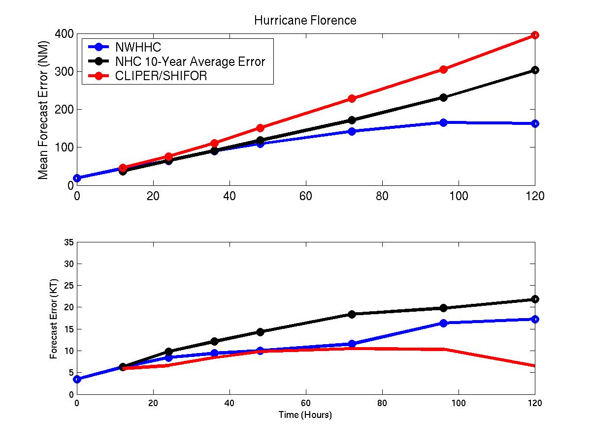
Figure 1: Mean track/intensity forecast errors for Hurricane Florence. Blue represents NWHHC forecast, black the best track, and red those of CLIPER/SHIFOR
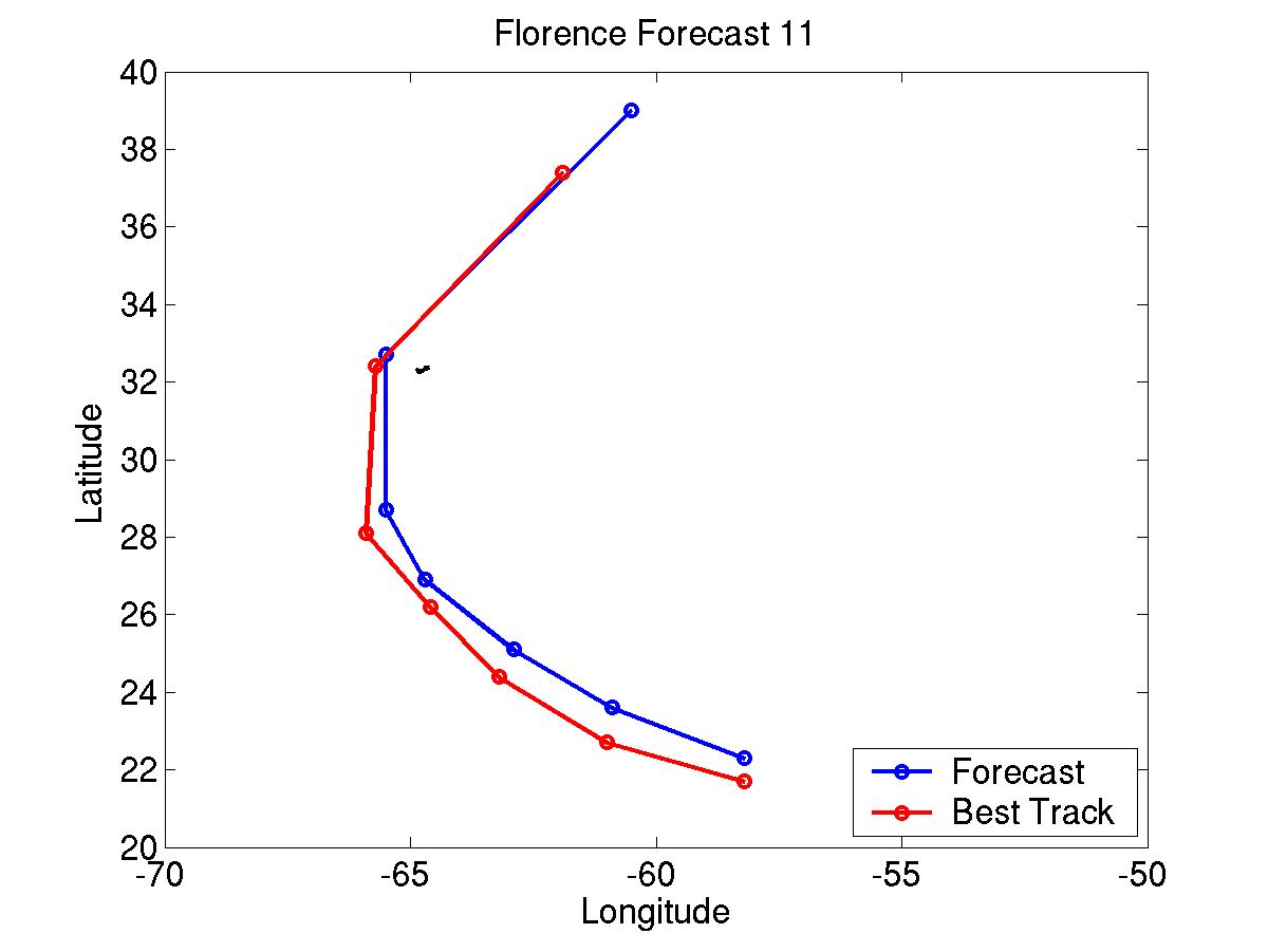
NWHHC forecast 11 and best track for Hurricane Florence. Forecast period through 96 hours. Blue represents NWHHC forecast and red the best track
Click Here for individual track/intensity forecast error statistics.
Table 1: Recommended Watches and Warnings
0300 UTC 9/9 Hurricane Watch: Bermuda
0900 UTC 9/9 Hurricane Watch/Tropical Storm Warning: Bermuda
0900 UTC 9/10 Hurricane WARNING: Bermuda
2100 UTC 9/11 Hurricane Warning Dropped: Bermuda
0300 UTC 9/12 Hurricane Watch: Burgeo to Bonavista, Newfoundland
1500 UTC 9/12 Hurricane Watch to Tropical Storm Warning: Burgeo to Bonavista
2100 UTC 9/12 Tropical Storm Warning Dropped: Newfoundland
Back to Verification Index