Tropical Storm Chris Forecast Verification
Written by Derek Ortt on December 31, 2007
The track forecasts at all time periods were better than the 10-year NHC mean error. However, at the 12 and 24 hour time periods, the errors were greater than those of CLIPER. The primary reason for this is due to an initial position error of more than 45NM in the first forecast. This resulted in very large errors at the 12 and 24 hour time periods. These errors were primarily due to Chris farther east of the forecast points. However, the forecasts always correctly a mainly westward track just north of the Caribbean.
The intensity forecast errors were greater than normal at all time periods except 72 hours. There was only one 72 hour forecast that verified due to the dissipation of Chris and had other forecasts verified, the 72 hour error would have been greater. The reason for this was the unexpected mid-level shear that impacted the storm as it moved north of the Caribbean.
Tropical Storm Warnings were recommended for the Leeward Islands north of Guadeloupe, though sustained tropical storm force winds did not occur. The lad time before the arrival of the center was 18-24 hours, a little longer than desired. The reason for the longer lead time was due to an incorrect center position in the first update, which placed Chris closer to the islands than it really was. These warnings are listed in the table below.
For synoptic history and official watches and warnings, please see the National Hurricane Center Tropical Cyclone Report
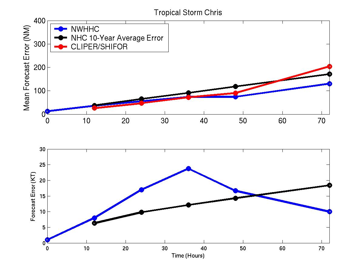
Mean track/intensity forecast errors for Tropical Storm Chris
Click Here for individual track/intensity forecast error statistics.
Table of Recommended Watches and Warnings
0300 UTC 8/1 Tropical Storm Warning: Leeward Islands north of Guadeloupe
0000 UTC 8/2 Tropical Storm Warning Dropped: South of an including Antigua
0900 UTC 8/2 Tropical Storm Warning Dropped: All
Back to Verification Index