Tropical Storm Beryl Forecast Verification
Written by Derek Ortt on December 5, 2007
The track forecasts for Tropical Storm Beryl had a mean error similar to that of the NHC 10-year mean error, except for the 72 hour time period. At this time period, the track error was significantly greater than the long-term mean. The errors were lower than those from CLIPER for all time periods except at 72 hours. The mean errors are shown in Fig. 1. There was only one 72 hour forecast that verified due to the extra-tropical transition of Beryl. if this forecast would have been excluded the mean error for the other time periods would have been significantly reduced. The reason why forecast one was so poor was a failure to initially anticipate the East Coast trough ejecting Beryl to the north and NE. Instead Beryl was forecast to linger east of the Carolinas for a while. This track reasoning was totally rejected 12 hours later with forecast 2. Forecasts 1 and 2 are graphically depicted in Fig. 2.
The intensity forecasts were outstanding with the greatest intensity forecast error being 10KT for the 36 hour time period in the first forecast. All other time periods had errors of 0 or 5KT. Beryl was correctly intensify to tropical storm intensity then weaken as it encountered increasing shear and cooler water.
a Tropical Storm Warning was recommended nearly 10 hours before landfall in Massachusetts from the MA/Rhode Island Border to Boston. A TS Warning was also recommended for Nova Scotia west of Halifax at 1000 UTC on July 21. This was dropped prior to beryl reaching the Canadian province as beryl became extra-tropical.
For synoptic history, and official watches and warnings, please see the National Hurricane Center Tropical Cyclone Report
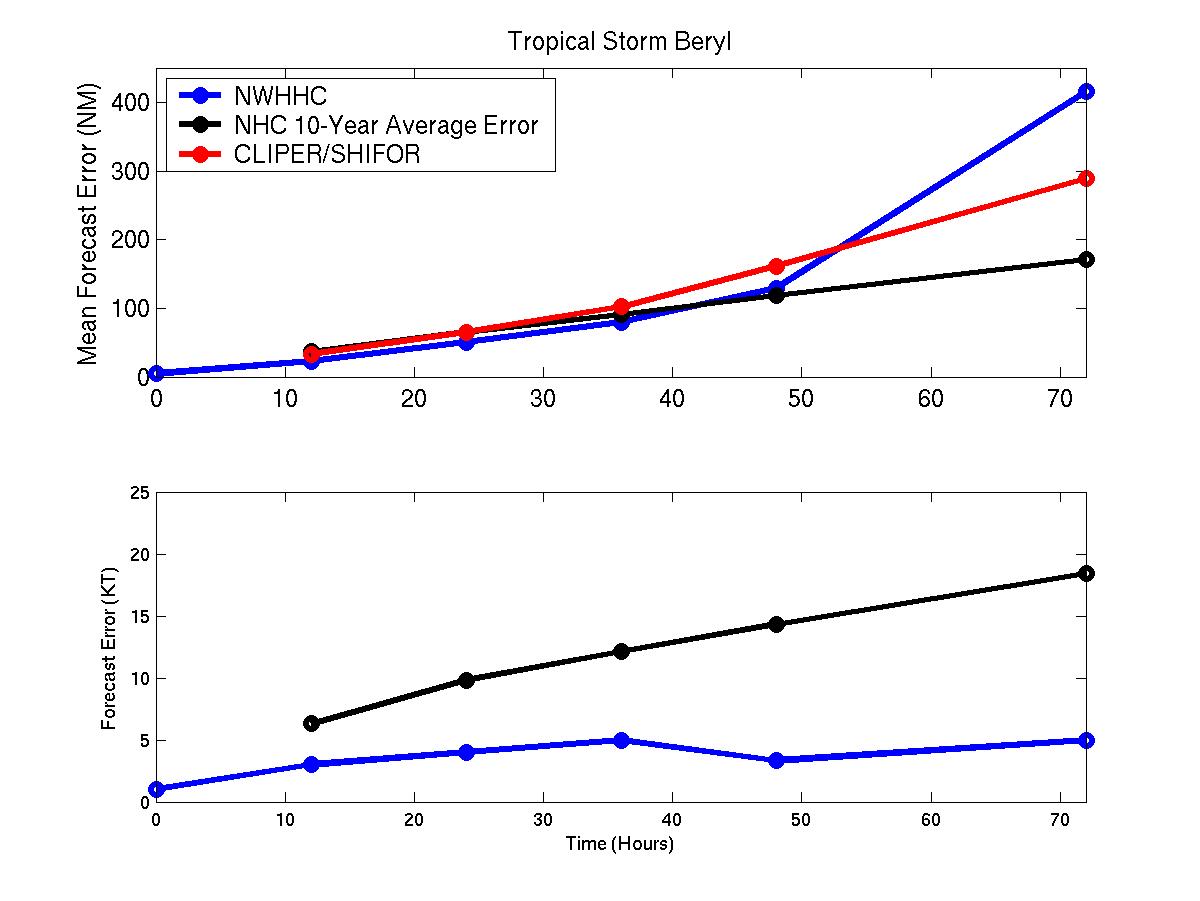
Figure 1: Mean track and intensity errors for Tropical Storm Beryl
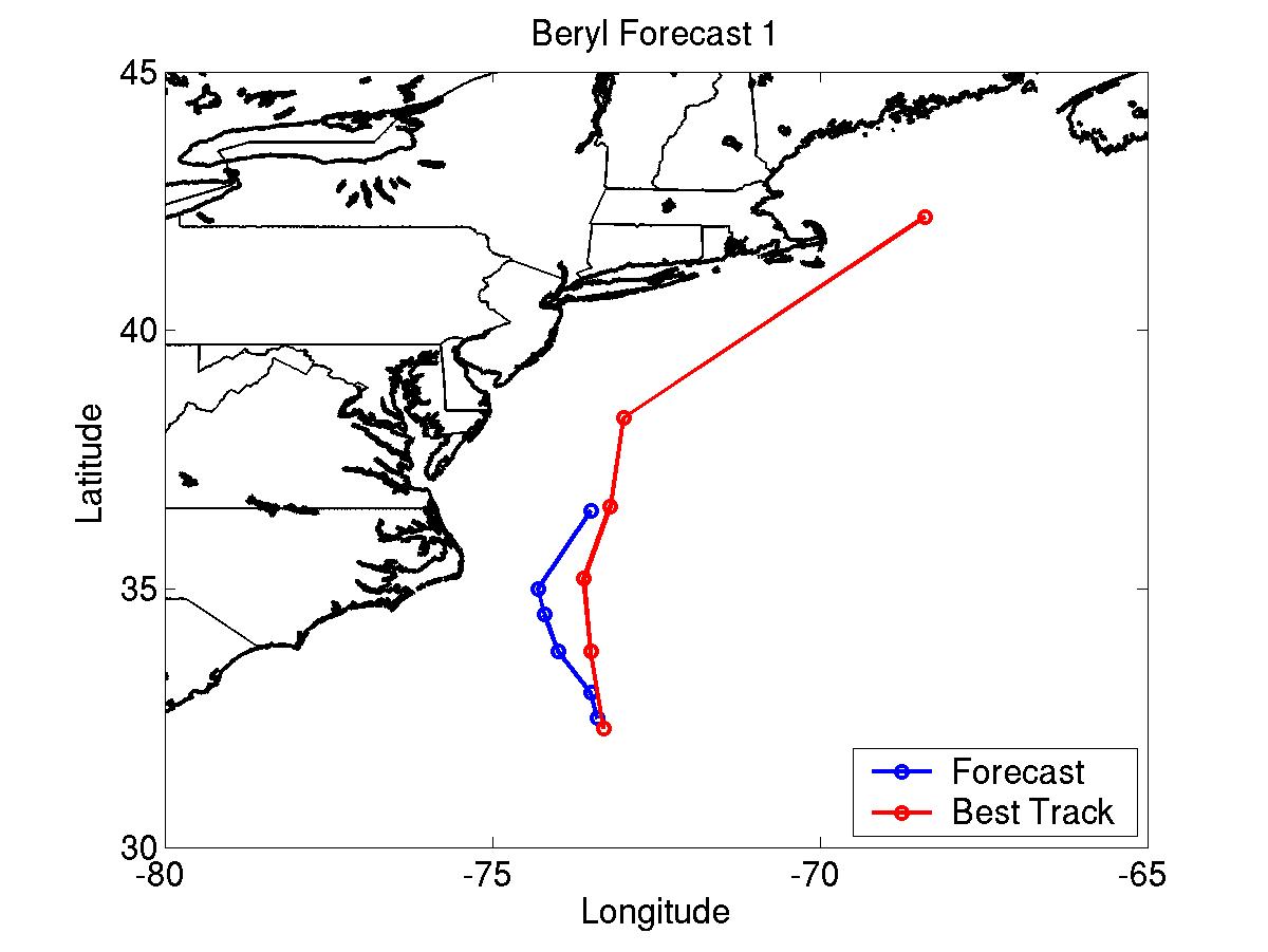
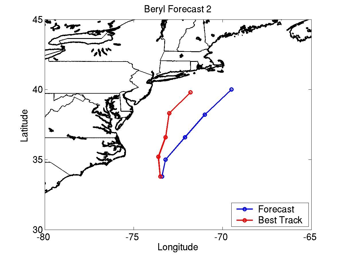 Figure 2: Beryl track forecasts 1 and 2 compared with the best track
Click Here for individual track/intensity forecast error statistics.
Back to Verification Index
Figure 2: Beryl track forecasts 1 and 2 compared with the best track
Click Here for individual track/intensity forecast error statistics.
Back to Verification Index