Tropical Storm Alberto Forecast Verification
Written by Derek Ortt on December 6, 2007
The track forecasts for Tropical Storm Alberto were quite poor. At all time periods, the mean error was greater than the NHC 10-year mean error. Furthermore, at the 12 and especially the 72 hour time periods, the mean error was greater than that of CLIPER. The 72 hour error was more than 160NM greater than CLIPER and was comparable to that of the interpolated GFDL. The errors are summarized in Fig. 1. The main source of error was related to the recurvature as Alberto interacted with the trough. The forecasts indicated that Alberto would be picked up more quickly than it was and that there would be a greater acceleration to the NE Figure 2 shows forecast 2 compared to the best track, illustrating the poor timing of recurvature.
The intensity forecasts were better with the longer time periods having errors significantly less than the long term mean. However, there were still some issues. The intensity fluctuation on June 12 was not well forecast. The forecasts did not indicate the rapid intensification that morning, nor did they indicate the rapid weakening prior to landfall. In fact, special forecast 6 issued at 1530 on June 2 indicated that Alberto would make landfall as a hurricane.
Immediately after Alberto was classified as a depression, a Tropical Storm Warning was recommended for western Cuba. Tropical storm force winds did not occur there, though torrential rainfall did. In Florida, a Hurricane Warning was initially recommended when recon data found Alberto on the verge of becoming a hurricane. This was changed to a Tropical Storm warning once it was clear than Alberto was weakening.
For synoptic history, as well as official watches and warnings, please see the National Hurricane Center Tropical Cyclone Report
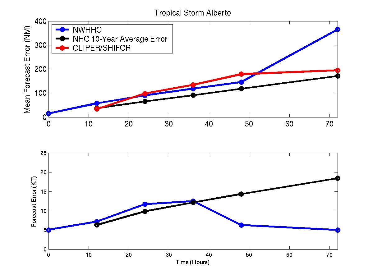
Figure 1: Mean track and intensity forecast errors for Alberto
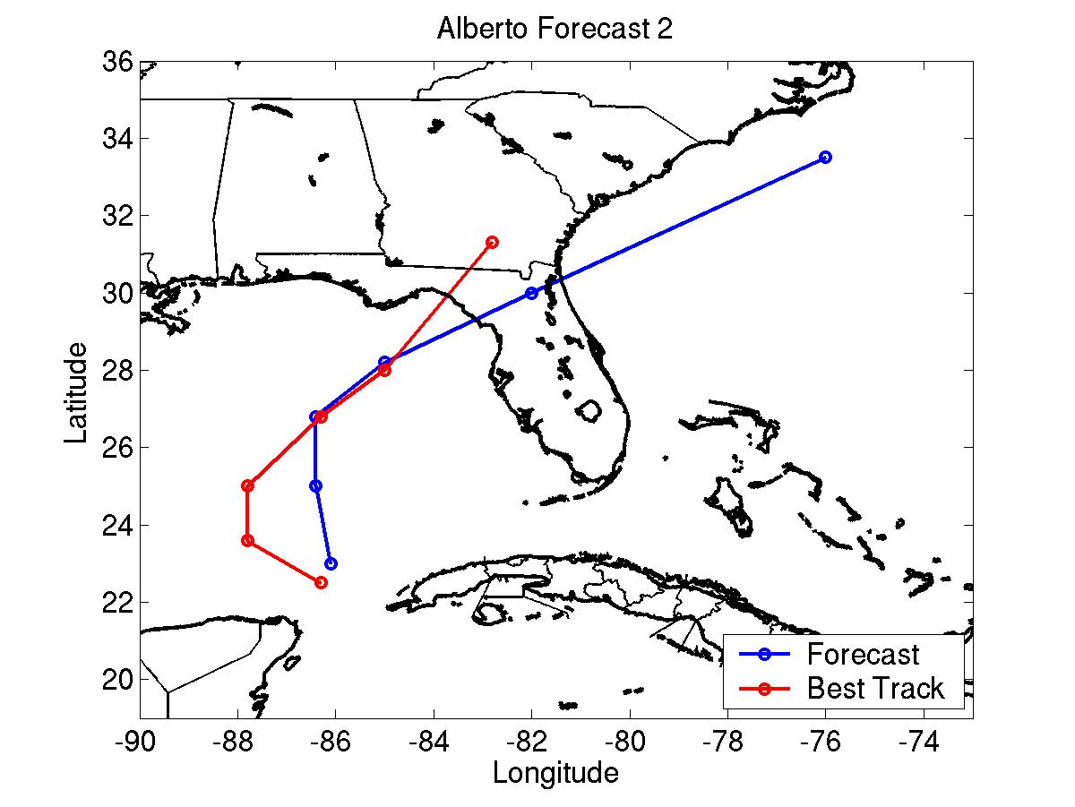
Figure 2: Alberto track forecast number two compared to the best track
Click Here for individual track/intensity forecast error statistics.
Table of Recommended Watches and Warnings
1500 UTC 6/10 Tropical Storm Warning: Cuba west of 84W
2100 UTC 6/10 Tropical Storm Warning Dropped: Cuba
1500 UTC 6/12 Hurricane WARNINGSt. Marks, Florida to Venice, Florida
2100 UTC 6/12 Hurricane Warning changed to Tropical Storm Warning: Venice to Tampa, Florida
0900 UTC 6/13 Hurricane Warning to Tropical Storm Warning: St. Marks to Tampa
0900 UTC 6/13 Tropical Storm Warning Dropped: Tampa to Venice
1800 UTC 6/13 Tropical Storm Warning Dropped: St. Marks to Tampa
Back to Verification Index