Hurricane Stan Forecast Verification
Written by Derek Ortt on May 13, 2006
Track forecast errors were at or greater than the long term average for all time periods. The main reason for this was the failure to anticipate the southerly turn after the hurricane emerged into the Bay of Campeche. Track forecasts indicated a westward motion. However, Stan turned to the SW. The SW turn resulted in a landfall about 12 hours sooner than expected.
Intensity forecasts, while good, also had large errors. The reason was the storm making landfall earlier than expected. Forecasts did correctly indicate that Stan would reach tropical storm intensity before making landfall on the Yucatan, and hurricane intensity before its final lnadfall.
For synoptic history, as well as the official watches and warnings, please see the National Hurricane Center Tropical Cyclone Report
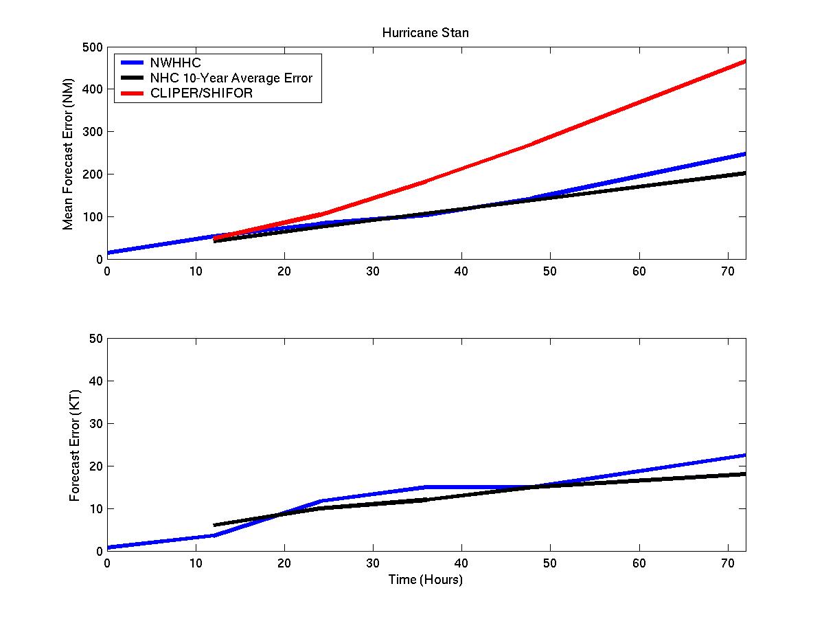
Track and intensity forecast errors for Hurricane Stan
Click Here for individual track and intensity forecast error statistics
Table of Recommended Watches and Warnings
10/2 0300 UTC Tropical Storm Warning: Chetumal, Mexico to Cancun, Mexico
10/2 2100 UTC Tropical Storm Warning: Cancun to Campeche, Mexico
10/2 2100 UTC Tropical Storm Warning Dropped: Cancun to Chetumal
10/3 0300 UTC Tropical Storm Warning Dropped: Cancun to Campeche
10/3 1200 UTC Hurricane Watch: Tampico, Mexico to Coatzacoalcos, Mexico
10/3 2100 UTC Hurricane WARNING: Tuxpan, Mexico to Coatzacoalcos
10/4 1200 UTC Hurricane Watch Dropped: Tuxpan to Tampico
10/4 1800 UTC Hurricane Warning Dropped: Tuxpan to Coatzacoalcos
Back to Verification Index