Hurricane Nate Forecast Verification
Written by Derek Ortt on August 11, 2006
While track forecast errors were well above the long-term mean for Nate, except at the 96 hour period, they forecasts showed a high level of skill. There were two main sources of error. As was the case with Irene, the center was hard to locate in the first two forecasts. Initial position errors were about 50NM in each case. The second source of error related to not accelerating the system to the NE fast enough after recurvature. Guidance tended to do better than the forecasts, especially the BAMD, which is a surprise as it does not typically perform this well under baroclinic situations.
In contrast, the intensity forecasts were significantly better than the long-term mean. Nate remained over the water and did not undergo any rapid intensity changes; therefore, these results should be expected.
For synoptic history, as well as official watches and warnings, please see the National Hurricane Center Tropical Cyclone Report on Hurricane Nate.
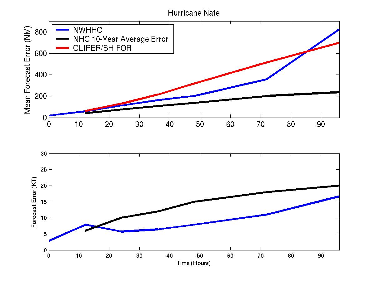
Mean track/intensity errors for Hurricane Nate
Click Here for individual track/intensity forecast errors
Back to Verification Index