Hurricane Irene Forecast Verification
Written by Derek Ortt on July 25, 2006
Track forecast errors were well above the long-term mean and had higher error than CLIPER, except at the 120 hour time period. This indicates that the forecasts had no skill. There were three main reasons for the large track errors. The first was due to difficulty in locating the initial center. Many initial position errors were greater than 30NM as the center was very poorly defined. In fact, many QUIKSCAT passes indicated that the system may have been an open wave for part of its duration. The second was a failure to capture center reformations early in its life-cycle, which resulted in a track slower and farther north of the forecast track. The third, and largest source of error was due to a failure to capture recurvature soon enough. Much of the guidance indicated a threat to the Mid Atlantic or New England, while Irene made a classic recurvature. It should be noted that no NWHHC forecasts brought Irene inland.
In contrast, intensity forecasts were better than the long-term mean, primarily due to the fact that the system remained over the water its entire life and there were no rapid changes in intensity.
For synoptic history, please refer to the National Hurricane Center Tropical Cyclone Report on Hurricane Irene.
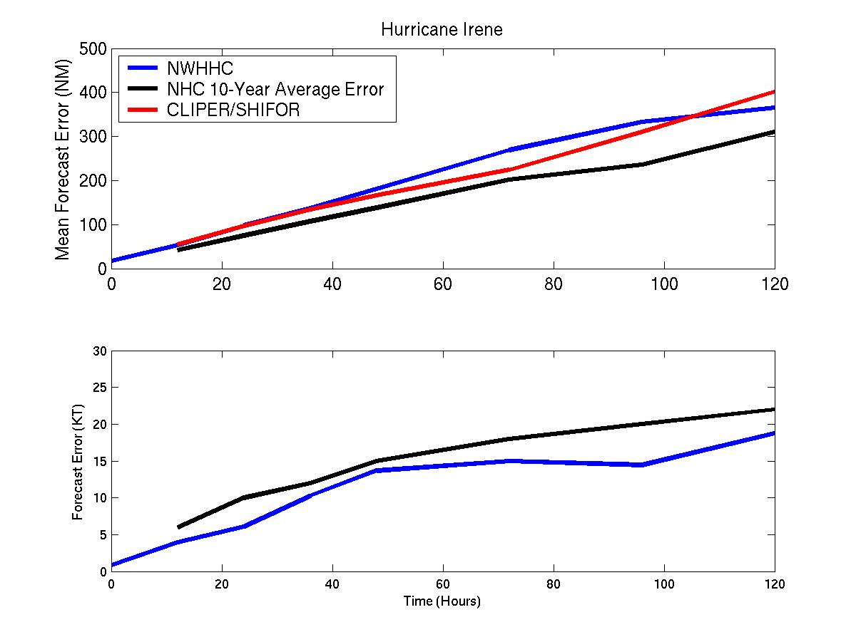
Mean track/intensity forecast errors for Hurricane Irene
Click Here for individual track/intensity forecast errors
Back to Verification Index