Tropical Storm Harvey Forecast Verification
Written by Derek Ortt on June 19, 2006
Track forecasts for Tropical Storm Harvey were very poor. At all time periods, the forecast error was greater than the long-term average. At the 96 and 120 hour time periods, the forecasts were significantly worse than those provided by CLIPER, which indicates that the forecasts had no skill. The main bias was northward. Forecasts indicated a track to the northeast, when the track was to the ENE, if not mainly easterly.
In contrast to the track forecasts, the intensity forecasts were much better than the long term average. The fact that Harvey remained over water may have contributed to this. Storms that interact with land often have large errors due to incorrect landfall forecasts.
A Tropical Storm Warning was recommended for Bermuda at 1500 UTC August 3 and discontinued it at 1000 UTC August 3. The warning was recommended about 15 hours prior to the closest pass to Bermuda. Ideally, NWHHC provides about 9-12 hours of lead time for a Tropical Storm Warning. However, the effects extended well away from the center; thus, the additional lead time was warranted.
For synoptic history, along with the official watches and warnngs, please see the National Hurricane Center Tropical Cyclone Report on Tropical Storm Harvey.
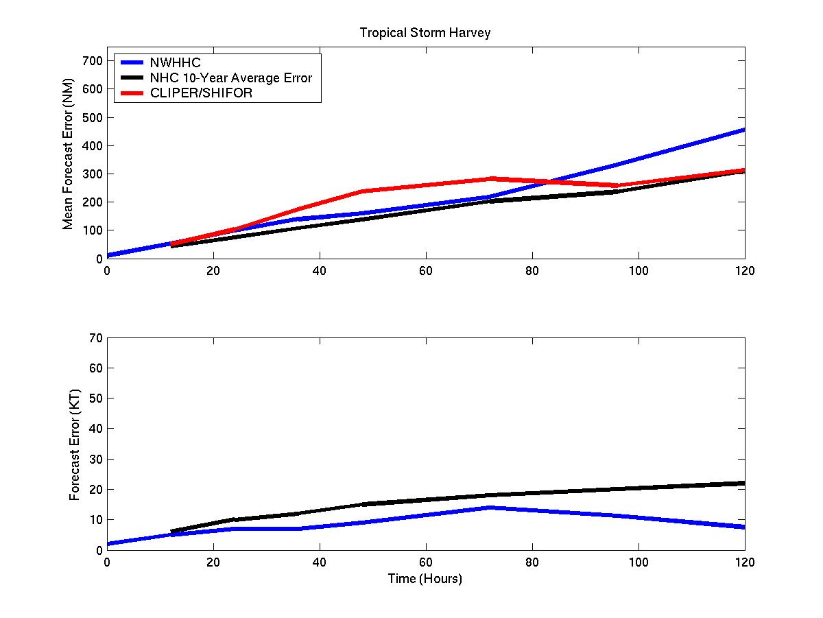
Mean track and intensity forecast errors
Click Here for individual track/intensity verification statistics.
Back to Verification Index