Hurricane Dennis Forecast Verification
Written by Derek Ortt on January 8, 2006
Track forecasts for Hurricane Dennis were better than average; however, there is room for improvement. There were two main source of track errors. The first was a northward bias while near the Florida Keys. The forecasts indicated a pass very close to the lower Keys, when the actual track was farther to the west. The second was not accelerating the storm fast enough in the Gulf of Mexico, keeping the hurricane over the Gulf too long. That said, a forecast about 48 hours prior to landfall (forecast 12) correctly indicated that the hurricane would landfall in Escambia Bay.
Intensity forecasts at all time periods were well below average. The rapid intensification in the Caribbean and Gulf were not well anticipated. In addition, the rapid weakening over Cuba was under-forecast. A third source of error was related to Keeping Dennis over the Gulf too long, and not weakening the hurricane quickly enough after landfall. This created one 120 hour intensity forecast to have an error of 100KT.
Watches and Warnings that were recommended were for the appropriate areas. However, there was not enough of an alert regarding the tidal surge flooding that occurred at St Marks. While winds were well below hurricane intensity there, and a Hurricane watch was recommended, there were no advisories regarding the 10 foot surge. In retrospect, at least a hurricane watch/Tropical Storm Warning should have been recommended for the entire Apalachee Bay.
For synoptic history, as well as the official watches and warnings, please see the National hurricane Center Tropical Cyclone Report on Hurricane Katrina.
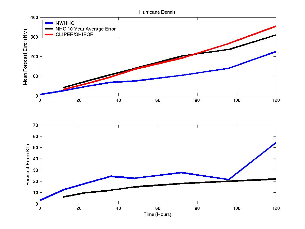
Mean Track and Intensity Errors for Hurricane Dennis
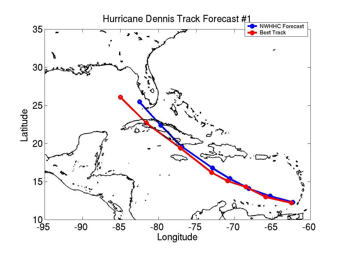
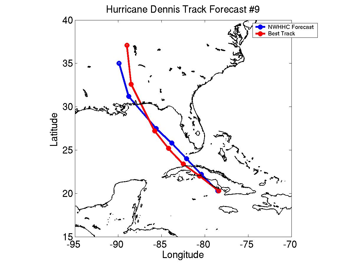
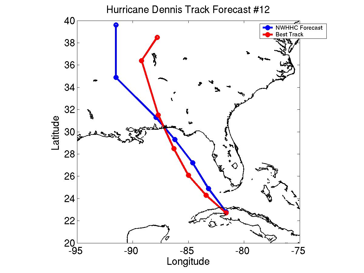
Track Forecasts 1, 9, and 12
Click Here for individual track/intensity error statistics
Table of Recommended Watches and Warnings
2100 UTC 7/5 Hurricane Watch: South Coast of Haiti and all of Jamaica
1200 UTC 7/6 Hurricane WARNING: South Coast of Haiti and all of Jamaica
1200 UTC 7/6 Hurricane Watch: Cayman Islands, South Coast of Cuba east of 80W
1200 UTC 7/6 Tropical Storm Warning: South Coast of Dominican Republic west of 69W
1500 UTC 7/6 Hurricane WARNING: South Coast of Cuba east of 78W
2100 UTC 7/6 Hurricane WARNING: South Coast of Cuba east of 80W, Little Cayman and Cayman Brac
2100 UTC 7/6 Hurricane Watch: All of Cuba east of 83W, not under Hurricane Warning
1200 UTC 7/7 Hurricane WARNING All of Cuba east of 80W
1200 UTC 7/7 Hurricane Watch: Cuba from 80-84W
1800 UTC 7/7 Hurricane Watch: Florida Keys
2100 UTC 7/7 Hurricane WARNING: All of Cuba and Florida Keys south and west of Marathon
2100 UTC 7/7 Tropical Storm Warning Dropped: Domincan Republic
1500 UTC 7/8 SUPER HURRICANE WARNING: South Coast of Cuba from 78.5 to 80W
1500 UTC 7/8 Hurricane Watches and Warnings Dropped: Cuba east of 77W, Jamaica, Cayman Islands, Haiti
1520 UTC 7/8 SUPER HURRICANE WARNING: Extended on South Coast of Cuba to 82W
1800 UTC 7/8 Super Hurricane Warning to Hurricane Warning: 78.5-82W on Cuban South Coast
2100 UTC 7/8 Hurricane Watch: Morgan City, Louisiana to St Marks, Florida
0700 UTC 7/9 Tropical Storm Warning: Florida Peninsula south of 27N
0900 UTC 7/9 Hurricane WARNING: Biloxi, Mississippi to Panama City, Florida
0900 UTC 7/9 Tropical Storm Warning: Florida Peninsula south of 27.5N
0900 UTC 7/9 Hurricane Warning Dropped: Cuba east of 80W
1800 UTC 7/9 Hurricane Warning Dropped: Cuba
2100 UTC 7/9 All Watches and Warnings Dropped: All areas, except for northern Gulf Coast
2300 UTC 7/9 Hurricane WARNING: Extended for Mississippi/Louisiana Border
1700 UTC 7/10: Hurricane Watch Dropped: West of Mouth of Mississippi River
2100 UTC 7/10: All Watches and Warnings Dropped: West of Florida/Alabama Border and east of Ft Walton Beach, FL
2300 UTC 7/10: Hurricane Warning Dropped: FL/AL border to Ft Walton beach
Back to Verification Index